Due to its geographical location, the city of Banjul (The Gambia) is especially exposed to a combination of the adverse effects of disasters. Only by taking measures aimed at improving the resilience of these communities the Government of The Gambia can protect the population. EO4SD-DRR has aimed at defining and implementing a demonstration of Earth Observation derived information in support to the analysis and monitoring of disasters and their impact in the coasts and urban areas of Banjul.
Demonstration exercise: Services supporting Disaster Risk Reduction in Greater Banjul
Countries of application: Banjul (The Gambia)
IFI: The World Bank
Service providers: Planetek (IT), ARGANS (FR), Indra (ES)
Services provided: Terrain deformation analysis (Planetek), Storm surge/Coastal flood analysis (ARGANS), Exposure mapping (Indra)
Main user: Government of The Gambia, Disaster Risk Management core team and practitioners in Africa
Other identified users: Kanifing Municipal Council (KMC), Ministry of Forestry and the Environment of The Gambia (MOFEN), , Gambia tourism board, University of The Gambia, Gambia Ports Authority, National Disaster Management Agency (NDMA), European Commission Delegation in The Gambia, UNOPS, African Development Bank (ADB), National Environmental Agency, Department of Physical Planning, Bureau of statistics
Area of interest: Greater Banjul area, 412,80 Km2 within the districts of Banjul, Kanifing, Kombo (partial).
Click here to access the Demonstration Exercise brochure
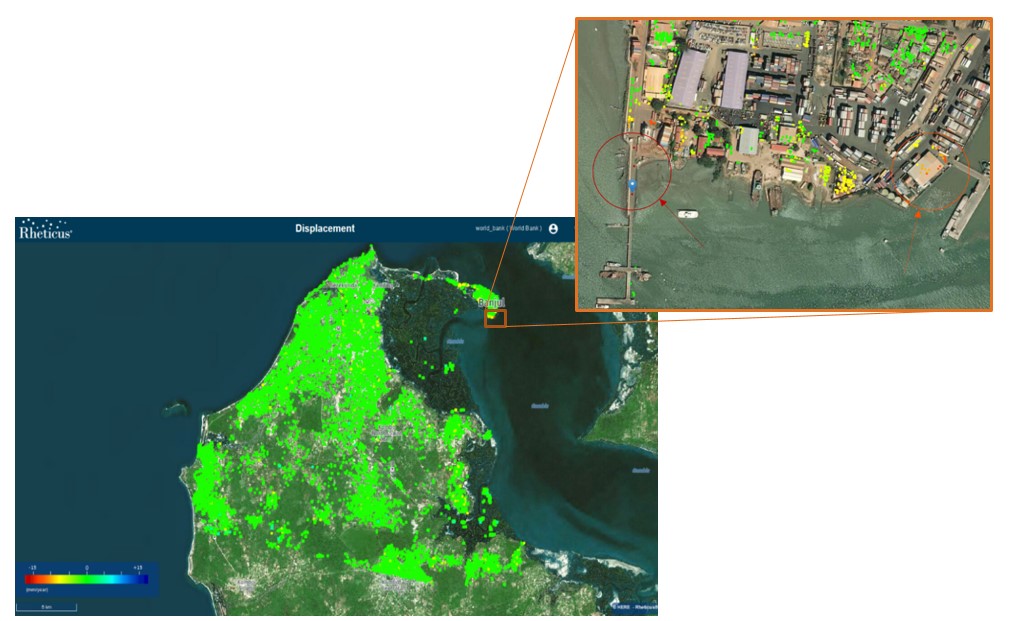 Ground motion phenomena calculated through Rheticus® Displacement over the Greater Banjul Area