World Bank – Dominican Republic – Training Sessions
Satellite-derived risk information for Spatial Data Infrastructures
The collaboration of EO4SD-DRR and the World Bank in the Dominican Republic has as main user the National Geographic Institute (IGN as its acronym in Spanish). The aim of the collaboration has been to prove the suitability of Earth Observation to provide geospatial data for disaster risk management at a large scale supporting the establishment of a national Spatial Data Infrastructure. Moreover, an Earthquake Impact Assessment was delivered given the current scenarios of seismic threats, tsunami and landslides over the Area of Interest.
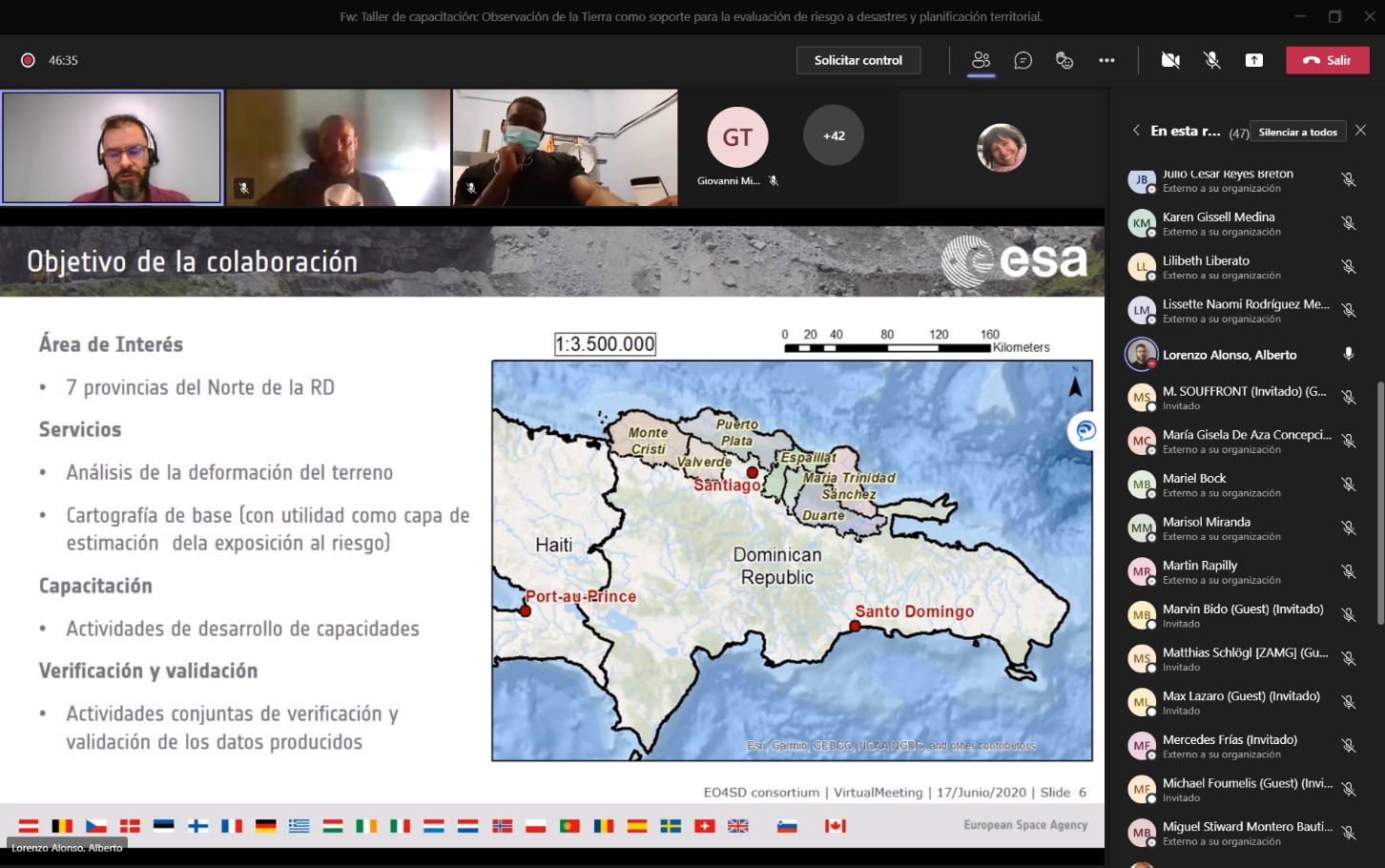
The Area of Interest (AOI) covers approximately 8,700 km² within the administrative provinces of the north coast of the Dominican Republic: Monte Christi, Valverde, Puerto Plata, Espaillat, Salcedo, Maria Trinidad Sánchez and Duarte. Two different services were provided under the collaboration, a Reference Map and an Earthquake Impact Assessment. Under the Reference Map, three products were delivered to the user, a land use map focused on urban associated uses, a transport network and an analysis of the urban areas for 2020 and its evolution since 2017.
These sessions were focused on technicians and experts that can be interested in EO techniques for their daily basis job. The first day, the products and services delivered were exposed with methodological notes and justification of the input data and techniques of application. The cluster focused on explaining the advantages of EO-based methodologies and how the products are obtained and can be easily generated and generally with no costs associated.
The second day, the cluster provided the attendees with a more applied session. An introduction to EO-data, where and how to download, how to exploit open source data for generation of land use and urban cartography and an updated transportation network. Moreover, a brief introduction of how a geospatial analysis can be applied in order to evaluate susceptibility to earthquakes was provided by ZAMG. The session ended with a focused talk on open source platforms of cloud processing.
The technical staff assistant to the training event was very keen of adopting EO-techniques. Several institutions have already departments focused on the application of these techniques and are especially open to mainstream EO in their processes.
Event category: Broad scope
IFI: World Bank
Cluster´s partners involved: ZAMG, Indra.
Main user: Instituto Geográfico Nacional José Joaquín Hungría Morell (National Geographic Institute or IGN as its acronym in Spanish).
Other users involved: National Office for Seismic Assessment and Vulnerability of Infrastructure and Buildings (ONESVIE by its Spanish acronym), University Geographic Institute, National Geographic Service, Military Cartographic Institute, Public Works Ministry, National Seismological Laboratory and Espaillat province strategic plan.
Number of participants: 50
Date: 17-18/06/2021
Location: Online
Official language: Spanish
Download the Training Sessions agenda