Asian Development Bank – Indonesia – Training Session 2
Space technology to support rehabilitation and reconstruction in Central Sulawesi
The aim of the collaboration between EO4SD-DRR and ADB, has been to support the last one´s requests in support to the Master Plan for Recovery and Reconstruction for Central Sulawesi launched by the Indonesian Government, after the earthquake event of 7.5 magnitude that struck Sulawesi Island in September 2018.
The training provided is focused on the stakeholders: IFIs TTLs, decision-makers, managerial representatives of Client states (i.e. DRM authorities, Ministries, Agencies).
The Asian Development Bank sponsored a second capacity building workshop held in Indonesia (Jakarta and Palu) since 27 to 31 January 2020 with the aim to scale the skills of the technical staff of relevant Indonesian Ministries and agencies on the Earth Observation web tools. by more than 120 participants from the Ministry of Public Works and Housing (MPWH), BAPPENAS, BNPB, LAPAN, and Palu local authorities and technicians.
The EO4D DRR project presented the outcomes of the second batch of services in support of the Emergency Assistance for Rehabilitation and Reconstruction Project (EARR) and Enhance Water Security Investment Project (EWSIP).
- Maps and status of the reconstruction monitoring progress after 1 year the event for buildings and roads in pilot areas of Palu city and Gumbasa irrigation channels
- Ground motion maps through the Rheticus® platform and basic principles of SAR technology.
- GEP capabilities and hands-on training session. Conducted by Terradue.
There were also several field visits to check on the ground the devastating effects of the earthquake to check the assessments estimated with VHR satellite images. Two examples: Petobo liquefaction area where an urbanized area was buried as in other areas assessed within Palu city and the blocking point of the Gumbasa irrigation channel.
Event category: Training
IFI: Asian Development Bank
Cluster´s partners involved: Planetek and Indra, with participation of Terradue
Main user: Government of Indonesia, Ministry of Agrarian Affairs and Spatial Planning / National Land Agency (BAPPENAS), Ministry of Public Works and Housing (MPWH)
Other users involved: Geospatial Information Agency – Badan Informasi Geospatial (BIG), LAPAN National Institute of Aeronautics and Space, BNPB
Number of participants: >60
Date: 27-31/01/2020
Location: Palu (Sulawesi)
Official language: English
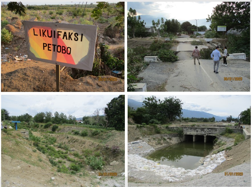 Field visits examples in Sulawesi: Petobo liquefaction area and Gumbasa primary channel
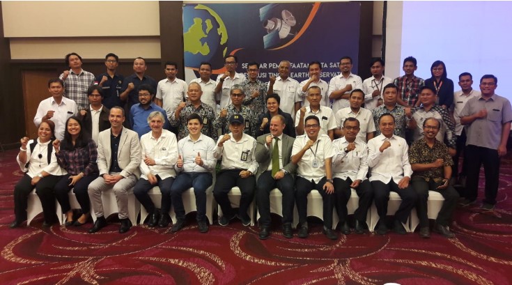 Closure of the EO4SD seminar in Palu city (Sulawesi)