The Instituto Geográfico Nacional José Joaquín Hungría Morell of the Dominican Republic has the legal mandate to implement a nationwide SDI which has been initiated with the technical support of the World Bank (WB). EO4SD-DRR has aimed at proving the suitability of Earth Observation to provide geospatial data for disaster risk management at a large scale.
Demonstration exercise: Satellite-derived risk information for Spatial Data Infrastructures
Countries of application: Dominican Republic
IFI: The World Bank
Service providers: ZAMG (AUS) and Indra (ES)
Services provided: Earthquake Impact Assessment (ZAMG), Reference Mapping (Indra)
Main user: Instituto Geográfico Nacional José Joaquín Hungría Morell (National Geographic Institute or IGN as its acronym in Spanish).
Other identified users: National Office for Seismic Assessment and Vulnerability of Infrastructure and Buildings (ONESVIE by its Spanish acronym), University Geographic Institute, National Geographic Service, Military Cartographic Institute, Public Works Ministry, National Seismological Laboratory and Espaillat province strategic plan.
Area of interest: */- 8,700 km² within the administrative provinces of the north coast of the Dominican Republic: Monte Christi, Valverde, Puerto Plata, Espaillat, Salcedo, Maria Trinidad Sánchez and Duarte.
Download the Demonstration Exercise Brochure
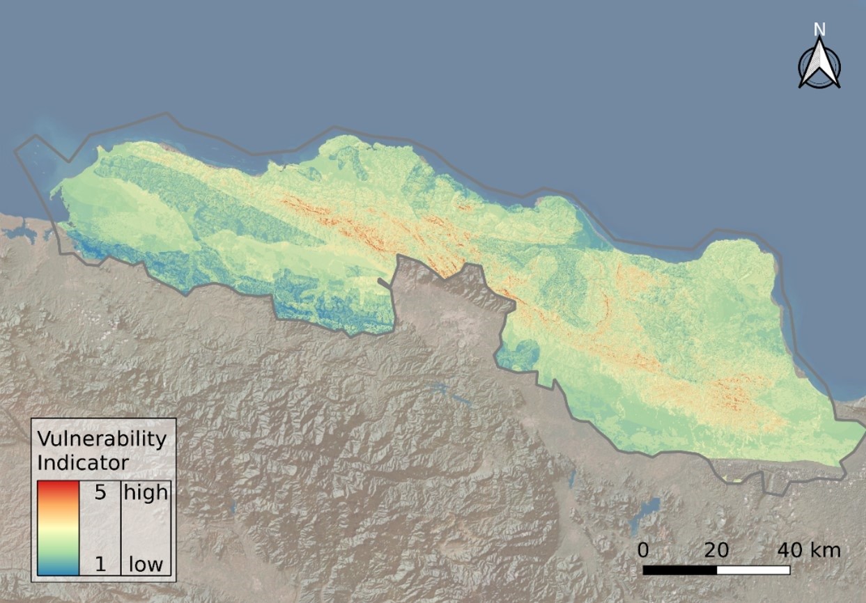
Indicator of Earthquake vulnerability